


|
|
|
|
|
|
|
Many thanks to Ms. Kasia Strzalkowska for the translation of this chapter from the book Gmina Cisna by Stanislaw Krycinski.
Wielki Low (Great Low) 1552, Wielki Luh (Great Luh) 1589; from Luh Wielki (from the Great Luh) 1609, Luch 1669, Luh XVIII / XIXc ; Luch or Luh 1884; Luh at the beginning of XXc, Ukrainian: … [Luh]. The name derives from Ukrainian … [luh] (in Polish it means: marshy meadow).
The village was founded on a Valachian law in the properties of Bals from Hoczwia. It owes its development to a settlement action lead by Matiasz III Bal. The first mention about Luh comes from the tax list of 1552. It follows that only then it had started to be settled. The next list, from 1567, brings the information that the village still had a tax exemption. On this basis it can be stated that the village arised after 1543. Local kniaz [nobile owner, local prince of lower level] received one lan [unit of cultivated land equal to 7.5-32 acres] of the salary. In 1589 there were already a few settled lans. The whole village lies on only one, west coast of Wetlinka stream/brook, that is a real great rarity in Polish Karpaty. Most probably villages Kalnica, Luh and Zawoj, initially situated in this part of the valley Wetlinka, extended on both banks. At this time the Bals possessed all the basins of Wetlinka, Solinka and Hoczewka, which they colonized successively. Before 1580 on the right bank of Wetlinka appears Jaworzec founded by the Kmita's who entered on Bal's territories in this way. The powerful house of the Kmita's didn't count with weaker neighbors. From the other sources we know that they were trying to widen their possessions in any manners, often inconsistent with law. But they didn't allowed to dislodge from above Wetlinka. They managed to save its left (west) bank beginning from Kalnica. After Matiasz III Bal's death, in 1598 the village fell to his son, a royal rotmistrz (cavalry captain), Samuel Bal. From the tax list of 1663, it's known that Luh was the property of Aleksander Bal at this time, grandson of Piotr Bal, who was the brother of Samuel. Apart from Luh he was owning also 25 of other villages. Aleksander Bal died young soon. His properties were inherited by the uncle (father's brother), Stefan Bal, who in 1670 was entrusted with south borders defense before Hungarian thugs invasion. Stefan Bal, the warrant officer of Przemysl, podkomorzy [chamberlain] of Sanok since 1660, had three sons from his marriage with Zofia: Michal, Stanislas and Jan IV. One of them inherited Luh, that remained in Bals' hands till the half of XVIII c at least. In the next century local possessions belonged to Lazowscy - first to Adolf, then to his
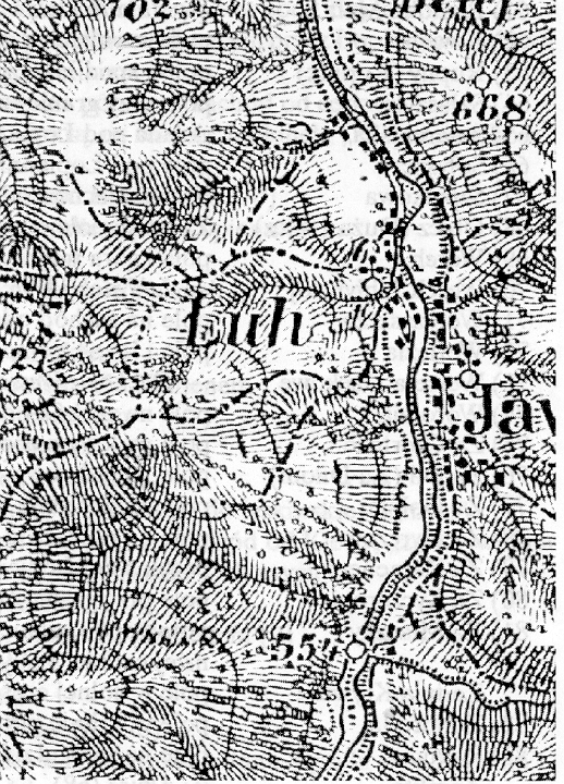 |
Luh on the Austrian topographical map 1:75 000 from 1914. Double zoom. /enlarged to twice the size/. |
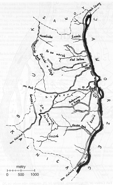 |
Luh. Map of the village according to the cadastral plan from 1852. |
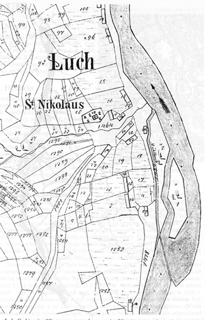 |
Luh. Orthodox Church (#18) on the cemetery, the inn (#28), inactive water-mill (#24), and a part of the village's buildings. Cadastral plan from 1852 of the scale 1:2880. |
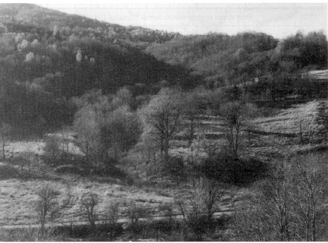
son Aleksander, who from the great property in Luh created in 1871 scholarships foundation for Polish literature students. This foundation has probably fallen fast, because at the end of XIX c. the property was already in Jewish hands. In 1868 area of the village amounted to 981 morgas (morgues) (564,6ha), including 304 morgues (175ha) of forests. Peasant grounds included 174,4 ha of arable lands, 85,7 ha of meadows and gardens, 41,4 ha of pastures, 16,7 ha of forests. In Autumn 1945 or at the beginning of 1946, about 140 inhabitants were enforced to be displaced to the Ukraine. Within the confines of "Wisla" action on 28 April - 10 May in 1947, 55 people more were displaced. There was nobody left in the village. At present, its terrain belongs to solectwo in Smerek. In the south part there are to see well kept terraces of former arable fields.
| before 1552 - till 1595 | Matiasz III Bal |
| since 1598 - till 1617 | Samuel Bal (son of Matiasz III) Piotr Bal (son of Matiasz III) |
| 1617-1646 | Adam Bal (son of Piotr) |
| about 1665-about 1690 | Stefan Bal (brother of Adam) |
| about 1690-1711 | Jan IV Bal (brother of Stefan) |
| 1711-about 1715 | Ignacy bal (son of Jan IV) |
| 1714-1770 | Barbara from Andrassy's Primo voto Bal, secundo voto Pothaym, and after her - Salomea Karsznicka from Bals |
| 1770 - before1790 | Piotr Karsznicki (son of Salomea) |
| 1790 Jan Rzeplinski till 1840 | Adolf Lazowski (died in 1840) |
| 1840-1871 | Aleksander Lazowski (son of Adolf)* |
| 1871-ab.1880 | scholarship foundation for Polish literature students (formed by A. Lazowski in 1871) |
| 1885 | Hersch Pachter |
| 1890 | Hersch Polmann and co-owners |
| 1904-ab.1910 | Mendel Pachter |
*In 1885 Cecylia baroness Wildberg is mentioned as a co-owner.
At the end of XVIII c. in the village lived families with such surnames: Babiak, Feszkanicz, Fusiak, Hajtko, Haluszczak, Hlodko, Kocuba, Kobyk, Kotanski, Kucyba, Lapej, Marko, Malycz, Mikula, Mruk, Obuszczak, Padlycz, Paranycz, Petrosz, Roman, Sterzen, Szpak, Tchir, Zuraw.
Surnames of inhabitants written down in years 1894 - 1944: Beca, Chitlewycz, Czerweniak, Dzendzia, Fenczyszyn, Hodowaniec, Hreszko, Lawer, Malyniak, Maruszczak, Mika, Oszczep, Papinczak, Tymciow.
 |
 |
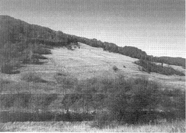
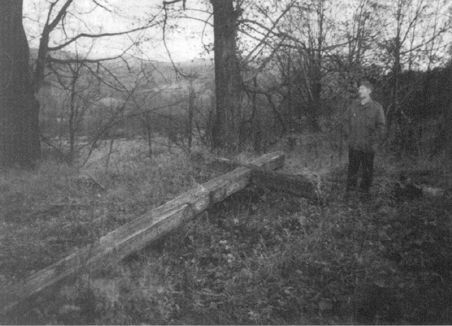
Terraces remained from agrable fields (1995) |
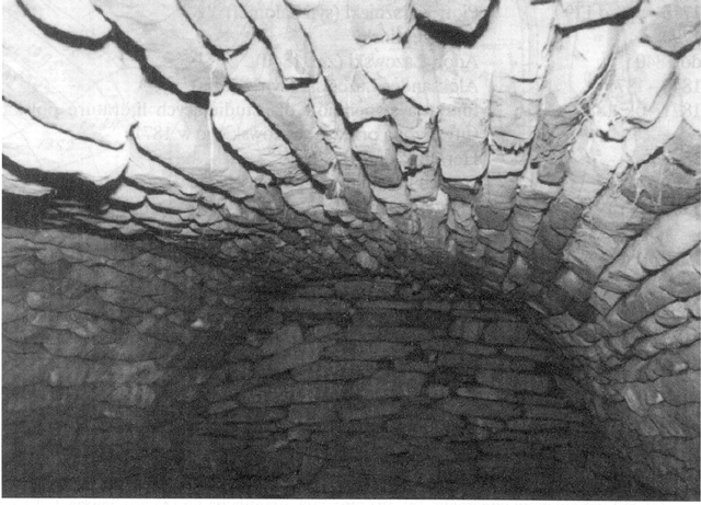
Luh.Stone cellar with 'cradle'vault - former building's remnant (1995). |
Year |
Number of Houses |
Number of Inhabitants |
Greek Catholic |
Roman Catholic |
Jewish |
Other |
| 1785 | 114 |
100 |
14 |
0 |
0 |
|
| 1790 | 86 |
|||||
| 1831 | 134 |
|||||
| 1835 | 128 |
|||||
| 1847 | 225 |
|||||
| 1849 | 173 |
|||||
| 1852 | 25 |
|||||
| 1857 | 168 |
|||||
| 1867 | 160 |
|||||
| 1869 | 29* |
190* |
||||
| 1873 | 166 |
|||||
| 1879 | 170 |
|||||
| 1880 | 185 |
|||||
| 1884 | 247 |
|||||
| 1890 | 268 |
|||||
| 1895 | 278 |
|||||
| 1910 | 297 |
2 (?) |
1 family |
0 |
||
| 1914 | 258 |
|||||
| 1918 | 254 |
|||||
| 1921 | 32 |
175 |
170 |
0 |
5 |
0 |
| 1921 | In the list 169 people declared as Rusyns, 6 as Poles
|
|||||
| 1930 | 198 |
|||||
| 1936 | 216 |
|||||
| 1938 | 226 |
|||||
| 1943 | 212 |
|||||
| 1945 | 192** |
|||||
| 1947 | 55/0*** |
|||||
| 1995 | 0 |
0 |
||||
* In the village lived 180 people in 28 houses.In the terrain of the manor there was 1 house and 10 inhabitants.
** Number of the people appointed for displacing by the authorities.
** * Before and after displacement at the time of "Wisla" action..
In a report drawn up in 1790, local rector mentioned eight children who were, in his opinion, able to go to school. In XIX and XX c. no school was written down here.
Greek Catholic Church
In the times of the first Republic of Poland there was a Greek Catholic parish church in Luh. Yet in 1767 Luh was a base of the parish with its branch in Zawoj. The parish was liquidated by the Austrian authorities in the eighties of XVIII. In 1790 the village belonged to the parish in Jaworzec. In the report written this year by the rector from Jaworzec we can read: "The parish Luzowiska is included to Jaworzec for closeness of a place. Local parishioners do not want to attend services / don't come to services/ to the parish (parochial of Jaworzec) because of their impudence, telling that they should have their services in their parish, which has no chalice, no equipment, no instruments at all in a word."
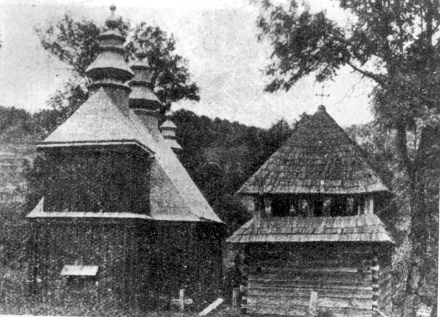
Branching Greek Catholic St. Nicolas the Wonder-worker church, wooden, built in 1864, destroyed after 1947. Preserved rests of underpinning, metal window, probably from the church and three old limes on the church's terrain.
The belfry
The wooden belfry, on a square plan constructed in the overlapping [beams are on one another blocking themselves] and skeletal way covered with tent roof. Destroyed after 1945. Preserved a fragment of underpinning.
 |
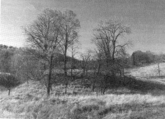
| Luh. Central part of the village with a place by the Greek Catholic Church and terraces by the fields. |
 |
 |
Luh. The St. Nicolas Greek Catholic Church (built in 1864) and a belfry (ab.1935). |
Luh. Place by the Greek Catholic Church (1995). |
 |
Luh. Wooden cross placed in 1938 in memory of 950th anniversary of Rus' baptism. |
Salary
On the village's terrain there was a ground formerly presenting the salary of local parish, in XIX and XX c belonging to / being a part of/ a parish in Jaworzec. In 1910 this salary amounted 36 morgues and 2208 sazen (Polish fathoms) of arable field and meadows, 4 fathoms of wood, 4 morgues of servitude field.
Church organizations
In interwar time there was a sobriety association.
Cemetery
Churchyard founded on the plan of irregular square with the area of 8,7 ha. It hasn't been expanded. Currently it's completely vandalized. There are only fragments of concrete headstones and a fallen oak cross with dates: 988-1938, placed here in the 950 anniversary of baptism of Rus.
Manor buildings were situated by the road coming through the village westwards from it, 750m north from the church. Through the manor maidan flew not a large brook, directing into the San. In 1852, north from this brook there was a bricked …
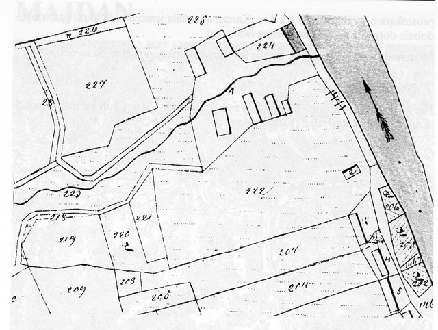 |
Luh. Manor buildings (No. 1 and 2) . Cadastral plan from 1852 of the scale 1:2880 |
… manor built on the plan of a rectangle with dimensions of 25,3x10, 4m. West there were 6 wooden farm buildings. In 1868 the great property constituted 246,3 ha, including arable soil of 88,1ha, forests of 158,3 ha. At the beginning of seventies of XIXc in the manor area there was one residential building, with 10 people living in it. In 1871, then owner of the property, AleksanderLazowski, formed the foundation of scholarships for the Polish literature students. Incomes from the local goods were supposed to be the source of financing the foundation. The venture could not have been successful, because the great property was in Jewish hands already in 1890. After 1910 the possessions have been parceled out. Between the Ist world war and the IInd world war the rests belonged to a Jew called Nuta, who lived in the local manor.
From the former building remained only underpinnings of the houses and a few 'cradle'vault stone cellars.
Inn that belonged to the manor is situated by the road coming through the village, at its west side, 330 m south from the Church. In 1852 it was a wooden building on the rectangle's plan of 14,4x8m. The inn existed here already in 1890 and it probably survived till World War I. Water-mill was in existence in the time before World War I and World War II. I wasn't able to find field names from the terrain of Luh. We know only the names plotted on the cadastral plans (on the village's map).
Source:
Bieszczady, Slownik Historyczno-Krajoznawczy, Czesc 2, Gmina Cisna.
By Marcin Gruszcynski, Wojciech Krukar, and Stanislaw Krycinski
Towarzystwo Karpackie
Wydawnictwo Stanislaw Krycinski
Warszawa 1996
ISBN 83-85531-07-6